
Belgrave Bridge - east side
Introduction
The photograph on this page of Belgrave Bridge - east side by John S Turner as part of the Geograph project.
The Geograph project started in 2005 with the aim of publishing, organising and preserving representative images for every square kilometre of Great Britain, Ireland and the Isle of Man.

There are currently over 7.5m images from over 14,400 individuals and you can help contribute to the project by visiting https://www.geograph.org.uk
Belgrave Bridge - east side
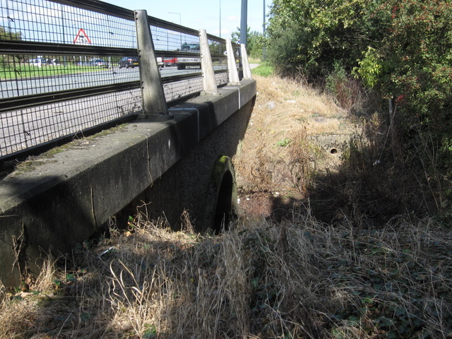
Image: © John S Turner Taken: 7 Sep 2009
This is the east side of Belgrave Bridge, which has been widened and strengthened in modern times. The west side of the bridge still has the old stone arch but is surmounted by the same concrete platform. The 1857 Ordnance Survey schedule for the 'Abstract of levelling from Newtown to Chester' records that benchmark number 120 was cut on the east parapet of this bridge, so this mark must have been destroyed when the bridge was widened. The cars in the distance are negotiating the A483/B5445 roundabout junction. See also Image
Images are licensed for reuse under creativecommons.org/licenses/by-sa/2.0
Image Location

Latitude
53.150163
Longitude
-2.916847