Montgomery Street
Introduction
The photograph on this page of Montgomery Street by Kenneth Mallard as part of the Geograph project.
The Geograph project started in 2005 with the aim of publishing, organising and preserving representative images for every square kilometre of Great Britain, Ireland and the Isle of Man.

There are currently over 7.5m images from over 14,400 individuals and you can help contribute to the project by visiting https://www.geograph.org.uk
Montgomery Street
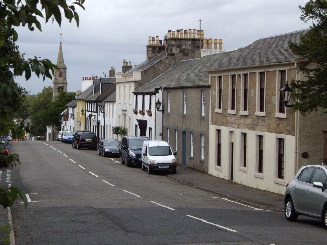
Image: © Kenneth Mallard Taken: 7 Sep 2009
Montgomery Street was originally named South Street. This view looks towards the crossroads with the Parish Church http://www.geograph.org.uk/photo/1424798 in the distance. In the lane beside Pillar House is Statue House, a museum owned by East Renfrewshire Council and dedicated to the work of local joiner and self-taught sculptor William Gemmell (1814 - 1891) . The museum contains a collection of William Gemmell's works. An online exhibition of the William Gemmell collection can be seen at Portal to the Past, East Renfrewshire's Heritage Collection http://www.eastrenfrewshire.gov.uk/heritage/heritage_exhibitions/williamgemmell.htm . Links to other views of Montgomery Street http://www.geograph.org.uk/photo/1484234 http://www.geograph.org.uk/photo/1484238 http://www.geograph.org.uk/photo/1484242 .
Images are licensed for reuse under creativecommons.org/licenses/by-sa/2.0
Image Location
Latitude
55.738939
Longitude
-4.274938