Winterborne St. Martin: postbox № DT2 96, Radio Station Cottages
Introduction
The photograph on this page of Winterborne St. Martin: postbox № DT2 96, Radio Station Cottages by Chris Downer as part of the Geograph project.
The Geograph project started in 2005 with the aim of publishing, organising and preserving representative images for every square kilometre of Great Britain, Ireland and the Isle of Man.

There are currently over 7.5m images from over 14,400 individuals and you can help contribute to the project by visiting https://www.geograph.org.uk
Winterborne St. Martin: postbox № DT2 96, Radio Station Cottages
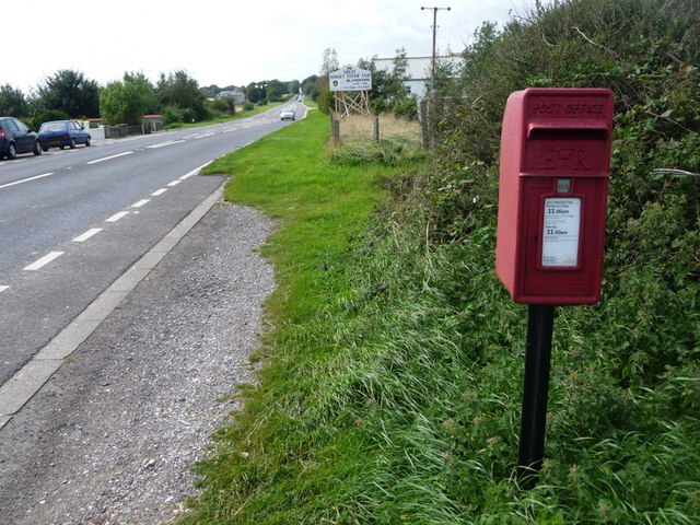
Image: © Chris Downer Taken: 29 Aug 2009
This little postbox stands just along from the radio communications mast which gives the cottages opposite, just out of picture, their name. This stretch of the A35 actually marks the boundary between Winterborne St. Martin parish and Bradford Peverell – the cottages are in Winterborne and the postbox in Bradford. The postbox is emptied daily, except Sunday, at 11am.
Images are licensed for reuse under creativecommons.org/licenses/by-sa/2.0
Image Location


Leaflet Map data © OpenStreetMap
Latitude
50.712211
Longitude
-2.487593