The Carrick Stone
Introduction
The photograph on this page of The Carrick Stone by Robert Murray as part of the Geograph project.
The Geograph project started in 2005 with the aim of publishing, organising and preserving representative images for every square kilometre of Great Britain, Ireland and the Isle of Man.

There are currently over 7.5m images from over 14,400 individuals and you can help contribute to the project by visiting https://www.geograph.org.uk
The Carrick Stone
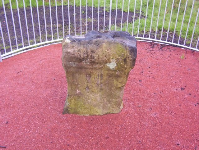
Image: © Robert Murray Taken: 9 Jun 2007
Allegedly a Roman altar. It certainly looks as if it could have been part of a bigger object. The long since demolished Carrickstone farm and the present surrounding suburb is named after the stone.
Images are licensed for reuse under creativecommons.org/licenses/by-sa/2.0
Image Location
Latitude
55.961723
Longitude
-3.99592