Cup-marked stone near Cerrig-y-gof
Introduction
The photograph on this page of Cup-marked stone near Cerrig-y-gof by Natasha Ceridwen de Chroustchoff as part of the Geograph project.
The Geograph project started in 2005 with the aim of publishing, organising and preserving representative images for every square kilometre of Great Britain, Ireland and the Isle of Man.

There are currently over 7.5m images from over 14,400 individuals and you can help contribute to the project by visiting https://www.geograph.org.uk
Cup-marked stone near Cerrig-y-gof
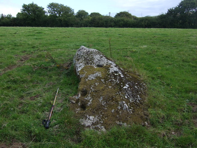
Image: © Natasha Ceridwen de Chroustchoff Taken: 4 Sep 2009
This prostrate boulder lies a short way to the northwest of the Cerrig-y-gof multi-chambered tomb and has distinct cup-marks several of which are the size of an espresso tasse.
Images are licensed for reuse under creativecommons.org/licenses/by-sa/2.0
Image Location


Leaflet Map data © OpenStreetMap
Latitude
52.014022
Longitude
-4.864104