Saltburn-by-the-Sea, from the Pier.
Introduction
The photograph on this page of Saltburn-by-the-Sea, from the Pier. by Gerald Massey as part of the Geograph project.
The Geograph project started in 2005 with the aim of publishing, organising and preserving representative images for every square kilometre of Great Britain, Ireland and the Isle of Man.

There are currently over 7.5m images from over 14,400 individuals and you can help contribute to the project by visiting https://www.geograph.org.uk
Saltburn-by-the-Sea, from the Pier.
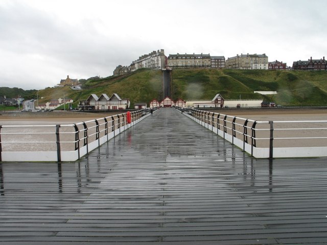
Image: © Gerald Massey Taken: 10 Aug 2009
Saltburn-by-the-Sea sports some fine Victorian architecture, including the attractive cliff-top terraces photographed here from the end of Saltburn's Victorian Pier. The steep ascent up the cliff face can be made via the Cliff Railway (need I say it, also Victorian), which is just visible at the pierhead.
Images are licensed for reuse under creativecommons.org/licenses/by-sa/2.0
Image Location
Latitude
54.584689
Longitude
-0.971935