Frinton-on-Sea: The level crossing
Introduction
The photograph on this page of Frinton-on-Sea: The level crossing by Nigel Cox as part of the Geograph project.
The Geograph project started in 2005 with the aim of publishing, organising and preserving representative images for every square kilometre of Great Britain, Ireland and the Isle of Man.

There are currently over 7.5m images from over 14,400 individuals and you can help contribute to the project by visiting https://www.geograph.org.uk
Frinton-on-Sea: The level crossing
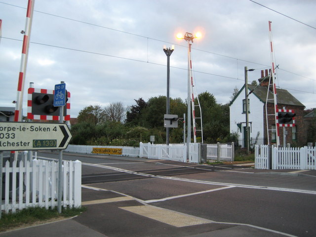
Image: © Nigel Cox Taken: 30 Aug 2009
The level crossing takes the B1033 road across the railway line to Walton-on-the-Naze and is the only main road into and out of Frinton-on-Sea. Historically it has always been the point at which the community was divided. One either lived inside the level crossing or outside it. Until recently the crossing had traditional gates and when, around 2006, Network Rail served their intention to replace the gates with modern lifting barriers, giving as their reasons cost and safety grounds, all manner of protests were arranged by the local population. At two o'clock in the morning of 18 April 2009, allegedly without notice, Network Rail pounced and replaced the old gates in one fell swoop overnight. The following morning about a hundred local people gathered to protest, but seemingly to no avail. The deed was done and this was the result. In fact the railway pre-dates the development of Frinton as a resort in late Victorian times, and the building with the white gable end, Frinton Gate House, was at one time the only structure for some distance around. The Ordnance Survey map of 1880 shows another level crossing of the railway close by and to the west of this one, joining what is now Whiton Wood Road with Frinton Road to the west of the present-day station.
Images are licensed for reuse under creativecommons.org/licenses/by-sa/2.0
Image Location
Latitude
51.837675
Longitude
1.244695