The Long Knowle Mound
Introduction
The photograph on this page of The Long Knowle Mound by John M as part of the Geograph project.
The Geograph project started in 2005 with the aim of publishing, organising and preserving representative images for every square kilometre of Great Britain, Ireland and the Isle of Man.

There are currently over 7.5m images from over 14,400 individuals and you can help contribute to the project by visiting https://www.geograph.org.uk
The Long Knowle Mound
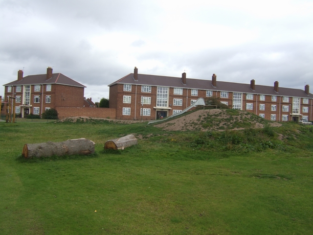
Image: © John M Taken: 5 Sep 2009
A crescent shape of engineered fill with grass was constructed earlier this year on the open space beside the school. The grass has not survived the weather or use by children during the school holidays and has been overtaken by weeds. The only green is the astro-turf next to the slide. When I saw the architect's proposals for this I expected something much larger. It turned out to be less a mound and more of a molehill.
Images are licensed for reuse under creativecommons.org/licenses/by-sa/2.0
Image Location
Latitude
52.612862
Longitude
-2.088864