Culmore old school, Omagh, circa 1904
Introduction
The photograph on this page of Culmore old school, Omagh, circa 1904 by Kenneth Allen as part of the Geograph project.
The Geograph project started in 2005 with the aim of publishing, organising and preserving representative images for every square kilometre of Great Britain, Ireland and the Isle of Man.

There are currently over 7.5m images from over 14,400 individuals and you can help contribute to the project by visiting https://www.geograph.org.uk
Culmore old school, Omagh, circa 1904
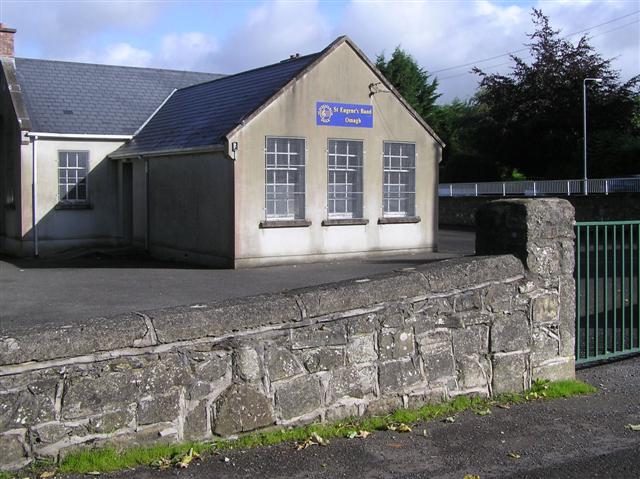
Image: © Kenneth Allen Taken: 4 Sep 2009
It is located along the Tamlaght Road. I was informed that there is a headstone embedded somewhere in the surrounding wall, but could not locate it. The school was no longer used for educational purposes when St Conor's Primary School was opened on the Brookmount Road. It became a youth club and then and St. Eugene's band took over the premises With the help of Mr Eugene Floyd, I did find it later on, see Image]
Images are licensed for reuse under creativecommons.org/licenses/by-sa/2.0
Image Location
Latitude
54.596335
Longitude
-7.32358