Aberystwyth Panorama
Introduction
The photograph on this page of Aberystwyth Panorama by Liam Tomkins as part of the Geograph project.
The Geograph project started in 2005 with the aim of publishing, organising and preserving representative images for every square kilometre of Great Britain, Ireland and the Isle of Man.

There are currently over 7.5m images from over 14,400 individuals and you can help contribute to the project by visiting https://www.geograph.org.uk
Aberystwyth Panorama
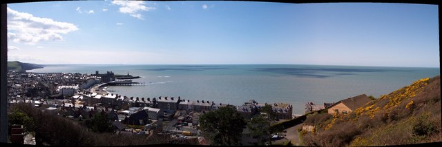
Image: © Liam Tomkins Taken: 4 Apr 2006
3 photos stitched together of the view from St Mary's Hall, Pen-Y-Graig. Places visible include Aberystwyth Harbour, Castle, Pier, Promenade, Court House and of course Cardigan Bay
Images are licensed for reuse under creativecommons.org/licenses/by-sa/2.0
Image Location


Leaflet Map data © OpenStreetMap
Latitude
52.419434
Longitude
-4.082147