Aberdeen Airport
Introduction
The photograph on this page of Aberdeen Airport by Martin Addison as part of the Geograph project.
The Geograph project started in 2005 with the aim of publishing, organising and preserving representative images for every square kilometre of Great Britain, Ireland and the Isle of Man.

There are currently over 7.5m images from over 14,400 individuals and you can help contribute to the project by visiting https://www.geograph.org.uk
Aberdeen Airport
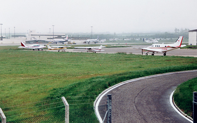
Image: © Martin Addison Taken: 3 Jul 1991
Looking across a general aviation parking area towards the terminal building from the met office below the control tower. I'm supposed to be taking the yellow and white Cessna, G-BOHJ, back to Southend, but I'm going nowhere in this clag - hence my visit to the met office.
Images are licensed for reuse under creativecommons.org/licenses/by-sa/2.0
Image Location
Latitude
57.204289
Longitude
-2.205557