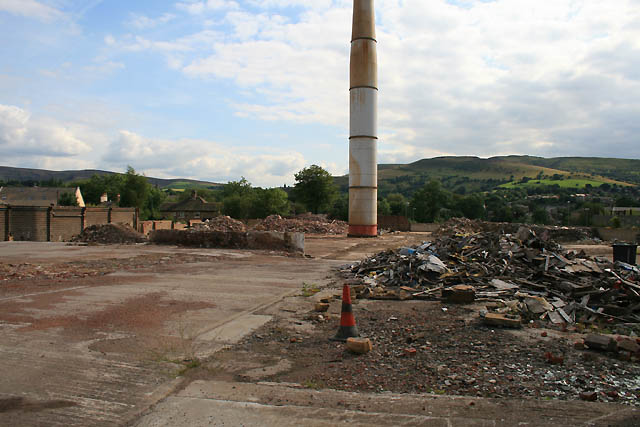
Ferro Alloys has gone
Introduction
The photograph on this page of Ferro Alloys has gone by David Lally as part of the Geograph project.
The Geograph project started in 2005 with the aim of publishing, organising and preserving representative images for every square kilometre of Great Britain, Ireland and the Isle of Man.
There are currently over 7.5m images from over 14,400 individuals and you can help contribute to the project by visiting https://www.geograph.org.uk

Image: © David Lally Taken: 13 Aug 2009
For a description of one of the processes which took place here see http://www.geograph.org.uk/photo/1125754, for a bit of nostalgia see http://www.geograph.org.uk/photo/1038032. The bit of wall still standing just to the left of centre is a 20m long x 2m high x 0.5m thick block of reinforced concrete built in about 1998 to counteract the bulging of the lower section of a brick wall which formed the northern end of the "crushing shop" as can be seen there was a difference in floor level of about half a metre between that and the "top shop" nearer the camera. The presence of underground springs meant that the ground under the "top shop" had swelled over the years seriously undermining what had been an exterior wall of the original iron foundry buildings. If I remember rightly the construction of this was my first capital expenditure request to United Industries following their take-over of Neepsend at the end of 1997 (for a bit about Neepsend see http://www.geograph.org.uk/photo/1301873 ). I still intend to describe more of the history of the Company - watch this square!

