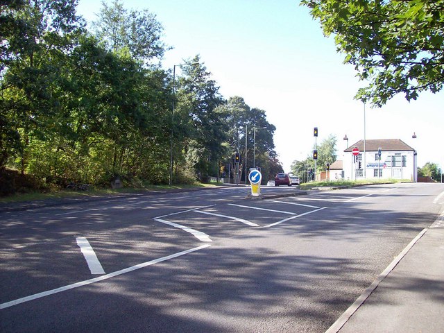
Jolly Farmer roundabout & Basing Stone
Introduction
The photograph on this page of Jolly Farmer roundabout & Basing Stone by Len Williams as part of the Geograph project.
The Geograph project started in 2005 with the aim of publishing, organising and preserving representative images for every square kilometre of Great Britain, Ireland and the Isle of Man.
There are currently over 7.5m images from over 14,400 individuals and you can help contribute to the project by visiting https://www.geograph.org.uk

Image: © Len Williams Taken: 1 Sep 2009
This is where the A30 separates into the Old Portsmouth Road, (left fork), and the A30 through Camberly (right fork). Situated on the roundabout is a golf pro shop which used to be the Jolly Farmer pub. Originally this was a posting inn situated at the top of the long drag up from Bagshot. The inn was originally called "The Golden Farmer" after a local farmer whose source of wealth was a mystery, until a highwayman was captured and found to be one and the same person ! The Basing Stone, which marks the parish boundary can be seen on the left hand side of the road.

