The Basing Stone
Introduction
The photograph on this page of The Basing Stone by Len Williams as part of the Geograph project.
The Geograph project started in 2005 with the aim of publishing, organising and preserving representative images for every square kilometre of Great Britain, Ireland and the Isle of Man.

There are currently over 7.5m images from over 14,400 individuals and you can help contribute to the project by visiting https://www.geograph.org.uk
The Basing Stone
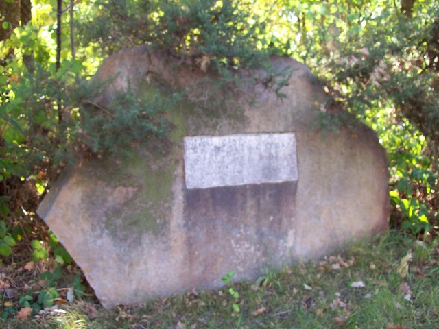
Image: © Len Williams Taken: 1 Sep 2009
This stone is located on the A30 adjacent to the traffic lights at the Jolly Farmer roundabout. The very worn plaque reads "SITE OF BASING STONE AND LEGEND OF THE WHITE HART". The stone, (which replaces an earlier one that was destroyed in the 1950's), marks the parish boundary. The legend of the White Hart, as given by a booklet: Medieval Surrey Heath. 1996 PJ Stevens is :- "Legend says that near the Basingstone (Beausantstone) Richard II was attacked by a wounded stag while hunting. He was apparently saved by a White Hart that came between them. In gratitude the King is said to have caused four hostelries with the sign of the White Hart to be erected in the forest at Bagshot, Chobham, Frimley, and Pirbright."
Images are licensed for reuse under creativecommons.org/licenses/by-sa/2.0
Image Location
Latitude
51.349102
Longitude
-0.712662