Former Eastry Hospital in Mill Lane
Introduction
The photograph on this page of Former Eastry Hospital in Mill Lane by John Baker as part of the Geograph project.
The Geograph project started in 2005 with the aim of publishing, organising and preserving representative images for every square kilometre of Great Britain, Ireland and the Isle of Man.

There are currently over 7.5m images from over 14,400 individuals and you can help contribute to the project by visiting https://www.geograph.org.uk
Former Eastry Hospital in Mill Lane
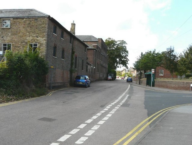
Image: © John Baker Taken: 30 Aug 2009
The road leaving Mill Lane in this picture is called Wheelwrights Way. The windows of the hospital overlooking Mill Lane have been boarded up. There appears to have been fire damage to part of the building. Planning permission has been granted by Dover District Council under application number DOV/14/00241 for the “minor demolition, and refurbishment/conversion of the Old Workhouse to provide 10 residential units; alterations and conversion of Tewkesbury House and the former Chapel to provide for community and employment space; reinstatement of the former Range building to provide a two storey terrace of 10 residential units (amended description and plans)”.
Images are licensed for reuse under creativecommons.org/licenses/by-sa/2.0
Image Location
Latitude
51.244038
Longitude
1.305322