Tramway on Gilwern Hill
Introduction
The photograph on this page of Tramway on Gilwern Hill by Trevor Rickard as part of the Geograph project.
The Geograph project started in 2005 with the aim of publishing, organising and preserving representative images for every square kilometre of Great Britain, Ireland and the Isle of Man.

There are currently over 7.5m images from over 14,400 individuals and you can help contribute to the project by visiting https://www.geograph.org.uk
Tramway on Gilwern Hill
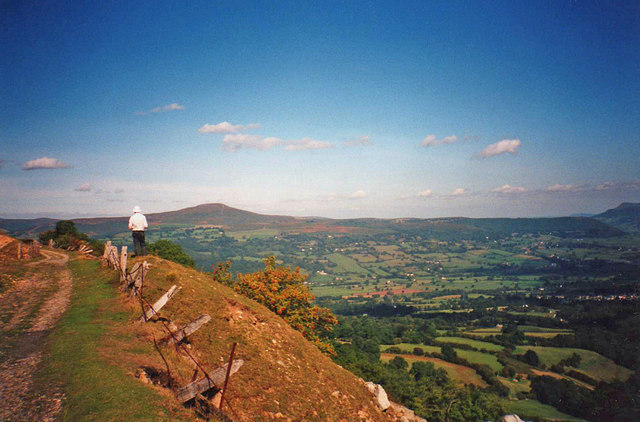
Image: © Trevor Rickard Taken: Unknown
Looking north across the Usk valley to the distinctive cone of the Sugar Loaf (Y Fal). On the extreme right is The Skirrid (Ysgyryd Fawr). This is part of Thomas Hill's Tramroad, which served the quarries on Gilwern Hill and Blorenge. http://www.world-heritage-blaenavon.org.uk/whs-info/nomination/hills/hilltram.htm
Images are licensed for reuse under creativecommons.org/licenses/by-sa/2.0
Image Location
Latitude
51.809285
Longitude
-3.093466