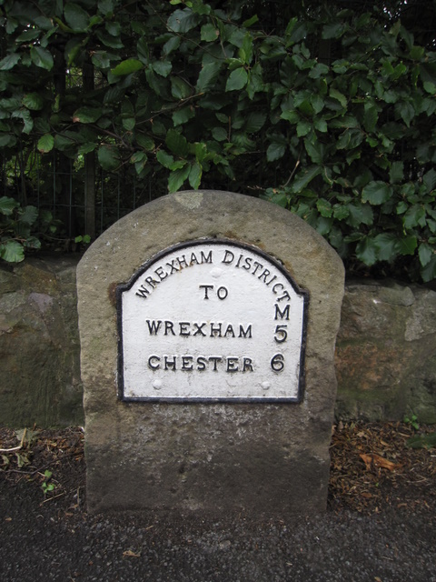
Milestone on Chester Road, Rossett
Introduction
The photograph on this page of Milestone on Chester Road, Rossett by John S Turner as part of the Geograph project.
The Geograph project started in 2005 with the aim of publishing, organising and preserving representative images for every square kilometre of Great Britain, Ireland and the Isle of Man.
There are currently over 7.5m images from over 14,400 individuals and you can help contribute to the project by visiting https://www.geograph.org.uk

Image: © John S Turner Taken: 31 Aug 2009
This milestone records that it is 5 miles to Wrexham and 6 miles to Chester, and significantly the plate bears the legend 'Wrexham District'. The Ordnance Survey schedule for the First Geodetic Levelling 1840-1860 records a bench mark on a mile stone at this location, but there is no sign of the mark on this stone. Wrexham District only came into existence in 1894, so it seems likely that the district council decided to modernise all their milestones and replaced the early one with this one. The 1880 O.S. map shows 'M.S./B.M.51.5', the 1900 map shows 'M.S./B.M.51.5' with the 'Meth. Chap.' recently built nearby, but without a bench mark, and the 1915 map shows 'M.S.' (no BM) and the 'Meth. Chap.' with a 'B.M.50.9.' This seems to confirm that the milestone was replaced between 1900 and 1915. For the bench mark on the former chapel see Image

