Family tree of the sub-surface lines
Introduction
The photograph on this page of Family tree of the sub-surface lines by Robert Lamb as part of the Geograph project.
The Geograph project started in 2005 with the aim of publishing, organising and preserving representative images for every square kilometre of Great Britain, Ireland and the Isle of Man.

There are currently over 7.5m images from over 14,400 individuals and you can help contribute to the project by visiting https://www.geograph.org.uk
Family tree of the sub-surface lines
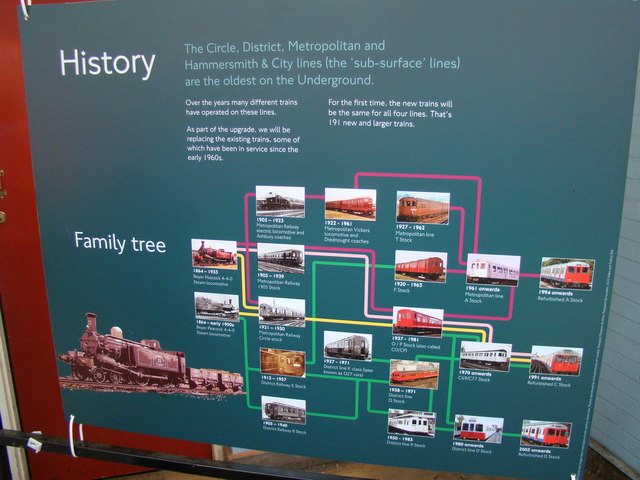
Image: © Robert Lamb Taken: 30 Aug 2009
An interesting family tree done in the style of the tube map showing all the stock used in the past and present on the sub-surface (Circle, District, Metropolitan and Hammersmith and City lines), sub-surface meaning that the tunnels are just below ground level and are thus taller and square-shaped compared to the small and arched tunnels of the deep-level stock, hence why the stock is taller and more box-shaped than deep-level stock.
Images are licensed for reuse under creativecommons.org/licenses/by-sa/2.0
Image Location
Latitude
51.561173
Longitude
0.264981