Traffic Warning Signs for Canal Bridge at Marsworth
Introduction
The photograph on this page of Traffic Warning Signs for Canal Bridge at Marsworth by Chris Reynolds as part of the Geograph project.
The Geograph project started in 2005 with the aim of publishing, organising and preserving representative images for every square kilometre of Great Britain, Ireland and the Isle of Man.

There are currently over 7.5m images from over 14,400 individuals and you can help contribute to the project by visiting https://www.geograph.org.uk
Traffic Warning Signs for Canal Bridge at Marsworth
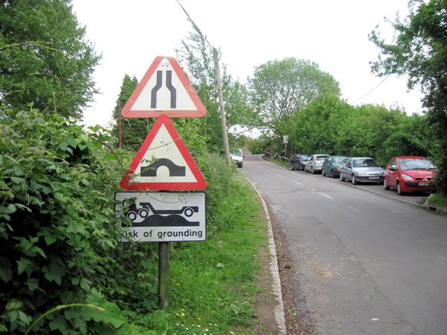
Image: © Chris Reynolds Taken: 20 May 2009
The bridges over the Grand Union Canal were not designed for modern traffic, and many on minor roads, such as the road from Marsworth to Gubblecote and Long Marston. Bridge No. 130 is too narrow for vehicles to pass, and the “hump back” means that as you approach the bridge you cannot see if anything is coming in the opposite direction. If the approach is steep there is also a danger of lorries with a long wheel base grounding on the top of the bridge. In addition there is a weight limit and iron bars will have been inserted to stop the bridge spreading under the weight of modern traffic. See Image The informal car park serves the people who live in nearby narrowboats, and fishermen. For more relevant pictures see Image
Images are licensed for reuse under creativecommons.org/licenses/by-sa/2.0
Image Location
Latitude
51.824282
Longitude
-0.668691