Railway bridge on western edge of Bury St. Edmunds
Introduction
The photograph on this page of Railway bridge on western edge of Bury St. Edmunds by John Goldsmith as part of the Geograph project.
The Geograph project started in 2005 with the aim of publishing, organising and preserving representative images for every square kilometre of Great Britain, Ireland and the Isle of Man.

There are currently over 7.5m images from over 14,400 individuals and you can help contribute to the project by visiting https://www.geograph.org.uk
Railway bridge on western edge of Bury St. Edmunds
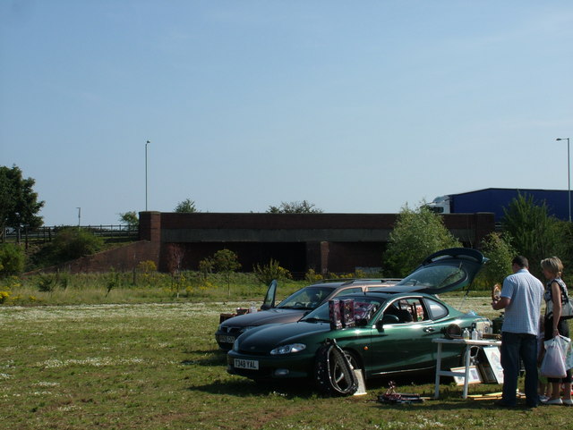
Image: © John Goldsmith Taken: 8 Aug 2009
A dual carriageway slip road links Newmarket Road, Bury St. Edmunds to a large roundabout giving access to Westley and Fornham villages and the A14. It passes over this very oblique railway bridge. In the photo a truck is heading westwards over the bridge. In the foreground we see a corner of a newly introduced Saturday car boot sale. This point marks roughly the western limit of the former Westley Airfield, which was used pre-war and during WW2, but largely turned into a housing estate in the 1950s.
Images are licensed for reuse under creativecommons.org/licenses/by-sa/2.0
Image Location
Latitude
52.253699
Longitude
0.67667