Whitstable Parish Hall
Introduction
The photograph on this page of Whitstable Parish Hall by Penny Mayes as part of the Geograph project.
The Geograph project started in 2005 with the aim of publishing, organising and preserving representative images for every square kilometre of Great Britain, Ireland and the Isle of Man.

There are currently over 7.5m images from over 14,400 individuals and you can help contribute to the project by visiting https://www.geograph.org.uk
Whitstable Parish Hall
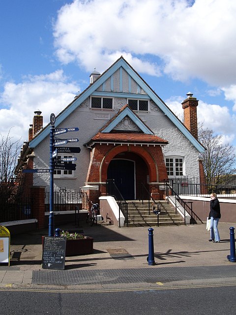
Image: © Penny Mayes Taken: 1 Apr 2006
Standing on the west side of Oxford Street in the town centre. The building houses the local branch of the Citizens Advice Bureau and Whitstable Umbrella Café.
Images are licensed for reuse under creativecommons.org/licenses/by-sa/2.0
Image Location


Leaflet Map data © OpenStreetMap
Latitude
51.356722
Longitude
1.023383