Former King's Head Inn
Introduction
The photograph on this page of Former King's Head Inn by Glyn Baker as part of the Geograph project.
The Geograph project started in 2005 with the aim of publishing, organising and preserving representative images for every square kilometre of Great Britain, Ireland and the Isle of Man.

There are currently over 7.5m images from over 14,400 individuals and you can help contribute to the project by visiting https://www.geograph.org.uk
Former King's Head Inn
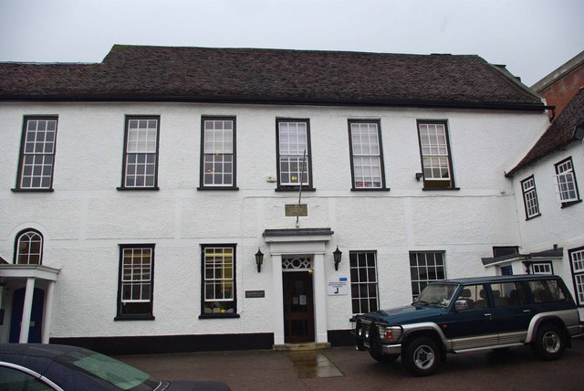
Image: © Glyn Baker Taken: 12 Aug 2009
This solicitor’s office was once the King’s Head Inn. In 1648 the Assembly room saw the conclusion to the English Civil War in the final surrender of the Royalists (the name of the venue being rather prophetic!). Colchester a parliamentarian Town had been taken over by the Royalists and was besieged by the New Model Army. After the war the parliamentarians demolished large sections of the defensive wall that had existed since Roman Times to ensure the town could not be so easily defended in future. See the plaque on the wall at Image
Images are licensed for reuse under creativecommons.org/licenses/by-sa/2.0
Image Location
Latitude
51.889239
Longitude
0.895785