The Old Mill House, Maypole Green
Introduction
The photograph on this page of The Old Mill House, Maypole Green by Bob Jones as part of the Geograph project.
The Geograph project started in 2005 with the aim of publishing, organising and preserving representative images for every square kilometre of Great Britain, Ireland and the Isle of Man.

There are currently over 7.5m images from over 14,400 individuals and you can help contribute to the project by visiting https://www.geograph.org.uk
The Old Mill House, Maypole Green
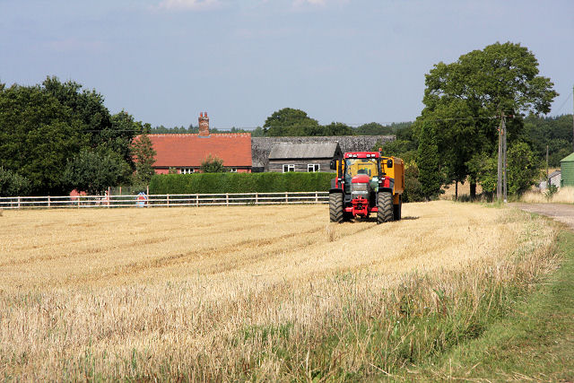
Image: © Bob Jones Taken: 18 Aug 2009
The track just visible to the right of the photo is Hollybush Lane, a byway leading to Bradfield St George. The stubble field has been recently harvested, as evidenced by the stationary tractor and trailer. The house behind the fence is The Old Mill House.
Images are licensed for reuse under creativecommons.org/licenses/by-sa/2.0
Image Location
Latitude
52.192768
Longitude
0.810266