Former railway line
Introduction
The photograph on this page of Former railway line by Bob Jones as part of the Geograph project.
The Geograph project started in 2005 with the aim of publishing, organising and preserving representative images for every square kilometre of Great Britain, Ireland and the Isle of Man.

There are currently over 7.5m images from over 14,400 individuals and you can help contribute to the project by visiting https://www.geograph.org.uk
Former railway line
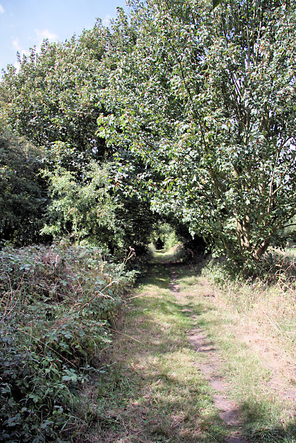
Image: © Bob Jones Taken: 18 Aug 2009
The railway line between Bury St Edmunds and Long Melford opened on 9 August 1865 and was closed to passengers on 10 April 1961 and freight on 19 April 1965. A public footpath now follows much of the route, as here near Earl's Hall Farm. Trees and bushes have grown along the line, such that in the distance there appears to be a tunnel entrance.
Images are licensed for reuse under creativecommons.org/licenses/by-sa/2.0
Image Location
Latitude
52.148676
Longitude
0.788629