Rasharkin Orange Hall - after attack
Introduction
The photograph on this page of Rasharkin Orange Hall - after attack by Dean Molyneaux as part of the Geograph project.
The Geograph project started in 2005 with the aim of publishing, organising and preserving representative images for every square kilometre of Great Britain, Ireland and the Isle of Man.

There are currently over 7.5m images from over 14,400 individuals and you can help contribute to the project by visiting https://www.geograph.org.uk
Rasharkin Orange Hall - after attack
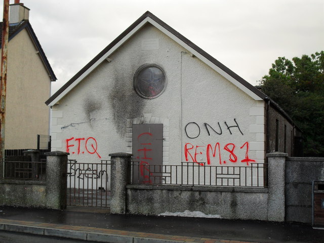
Image: © Dean Molyneaux Taken: 23 Aug 2009
This Orange Hall was attacked on several occasions, see http://news.bbc.co.uk/1/hi/northern_ireland/8210435.stm The graffiti outside likely means nothing to someone unfamiliar with the conflict here - I shall briefly outline what they mean. They are not a representation of my own political views in any way - solely for reference. FTQ - 'Q' stands for Queen, I'll leave the rest to your imagination. 32CSM - 32 County Sovereignty Movement (a republican group) ONH - 'Oglaigh na hEireann', Irish for I.R.A. REM.81 - Remember 1981, a reference to the Hunger Strikes of that year. CIRA - Continuity Irish Republican Army.
Images are licensed for reuse under creativecommons.org/licenses/by-sa/2.0
Image Location
Latitude
54.957216
Longitude
-6.48144