Lodge Farm
Introduction
The photograph on this page of Lodge Farm by Simon Carey as part of the Geograph project.
The Geograph project started in 2005 with the aim of publishing, organising and preserving representative images for every square kilometre of Great Britain, Ireland and the Isle of Man.

There are currently over 7.5m images from over 14,400 individuals and you can help contribute to the project by visiting https://www.geograph.org.uk
Lodge Farm
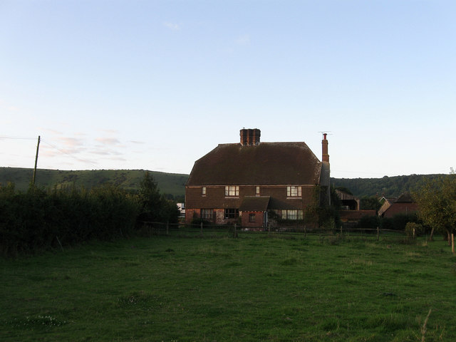
Image: © Simon Carey Taken: 23 Aug 2009
The farmhouse viewed from New Road, the B2112. The land around was originally part of Ditchling Park, a former deer park that began life as a stud farm for Alfred the Great. It was enclosed in the late 16th century and as the name of the farm suggests the former lodge house has most likely become the farm. Not certain of the antiquity of the building but it does look at least 18th century.
Images are licensed for reuse under creativecommons.org/licenses/by-sa/2.0
Image Location
Latitude
50.915782
Longitude
-0.129574