Ramp to the flood barrier near Woolwich
Introduction
The photograph on this page of Ramp to the flood barrier near Woolwich by Stephen Craven as part of the Geograph project.
The Geograph project started in 2005 with the aim of publishing, organising and preserving representative images for every square kilometre of Great Britain, Ireland and the Isle of Man.

There are currently over 7.5m images from over 14,400 individuals and you can help contribute to the project by visiting https://www.geograph.org.uk
Ramp to the flood barrier near Woolwich
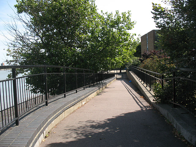
Image: © Stephen Craven Taken: 23 Aug 2009
Downstream of the Thames barrier a continuous flood defence level has to be maintained along each side of the river to protect low-lying properties; in some places that means having an artificial barrier across the Thames Path. Here, the flood defence level is represented by a brick wall and the path crosses it by means of this zig-zag cycle ramp and by a 'designer' set of steps Image
Images are licensed for reuse under creativecommons.org/licenses/by-sa/2.0
Image Location
Latitude
51.494585
Longitude
0.052204