Bournemouth: Weston Drive beneath red, white and blue
Introduction
The photograph on this page of Bournemouth: Weston Drive beneath red, white and blue by Chris Downer as part of the Geograph project.
The Geograph project started in 2005 with the aim of publishing, organising and preserving representative images for every square kilometre of Great Britain, Ireland and the Isle of Man.

There are currently over 7.5m images from over 14,400 individuals and you can help contribute to the project by visiting https://www.geograph.org.uk
Bournemouth: Weston Drive beneath red, white and blue
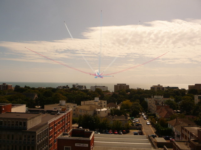
Image: © Chris Downer Taken: 21 Aug 2009
Looking down from an office-block rooftop onto the short cul-de-sac of Weston Drive. Our attention, however, is drawn not to the ground but to the Red Arrows' display over the bay.
Images are licensed for reuse under creativecommons.org/licenses/by-sa/2.0
Image Location
Latitude
50.721244
Longitude
-1.862112