"A Grassy Wilderness" information board, Woodbridge Meadows, Guildford
Introduction
The photograph on this page of "A Grassy Wilderness" information board, Woodbridge Meadows, Guildford by P L Chadwick as part of the Geograph project.
The Geograph project started in 2005 with the aim of publishing, organising and preserving representative images for every square kilometre of Great Britain, Ireland and the Isle of Man.

There are currently over 7.5m images from over 14,400 individuals and you can help contribute to the project by visiting https://www.geograph.org.uk
"A Grassy Wilderness" information board, Woodbridge Meadows, Guildford
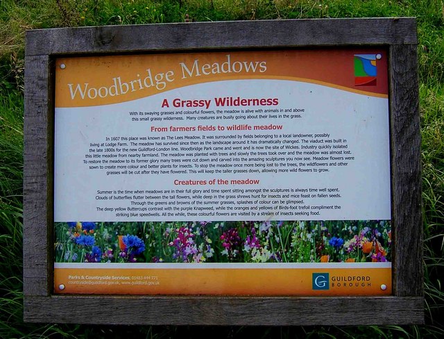
Image: © P L Chadwick Taken: 15 Aug 2009
The board explains that in 1607 the area here was known as "The Lees Meadow". The meadow survived various changes and has now been restored. Also gives details of some of the creatures to be found in the meadow.
Images are licensed for reuse under creativecommons.org/licenses/by-sa/2.0
Image Location
Latitude
51.245434
Longitude
-0.581454