Wellington and Queen Elizabeth Bridges
Introduction
The photograph on this page of Wellington and Queen Elizabeth Bridges by Colin Smith as part of the Geograph project.
The Geograph project started in 2005 with the aim of publishing, organising and preserving representative images for every square kilometre of Great Britain, Ireland and the Isle of Man.

There are currently over 7.5m images from over 14,400 individuals and you can help contribute to the project by visiting https://www.geograph.org.uk
Wellington and Queen Elizabeth Bridges
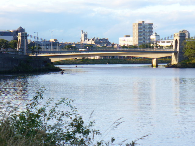
Image: © Colin Smith Taken: 11 Aug 2009
The nearer bridge, the Wellington Suspension or Chain Bridge, dates from 1830 and is now only open to pedestrian traffic. The farther, Queen Elizabeth Bridge was built in 1983 and carries the trunk road traffic into Aberdeen from the south.
Images are licensed for reuse under creativecommons.org/licenses/by-sa/2.0
Image Location
Latitude
57.133626
Longitude
-2.0958