O'Toole's Pub, The Heights, Loughinisland
Introduction
The photograph on this page of O'Toole's Pub, The Heights, Loughinisland by Dean Molyneaux as part of the Geograph project.
The Geograph project started in 2005 with the aim of publishing, organising and preserving representative images for every square kilometre of Great Britain, Ireland and the Isle of Man.

There are currently over 7.5m images from over 14,400 individuals and you can help contribute to the project by visiting https://www.geograph.org.uk
O'Toole's Pub, The Heights, Loughinisland
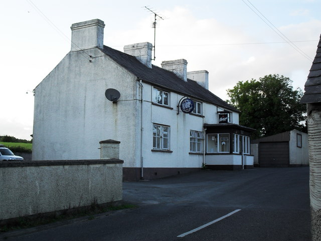
Image: © Dean Molyneaux Taken: 15 Aug 2009
On The Heights. Scene of a loyalist massacre on 18th June 1994 - Six civilians were killed. The community have insisted that the bar should remain open. Loughinisland is a predominantly Roman Catholic village, however was otherwise unscathed by The Troubles.
Images are licensed for reuse under creativecommons.org/licenses/by-sa/2.0
Image Location
Latitude
54.338945
Longitude
-5.824982