Lowes Arms
Introduction
The photograph on this page of Lowes Arms by Gerald England as part of the Geograph project.
The Geograph project started in 2005 with the aim of publishing, organising and preserving representative images for every square kilometre of Great Britain, Ireland and the Isle of Man.

There are currently over 7.5m images from over 14,400 individuals and you can help contribute to the project by visiting https://www.geograph.org.uk
Lowes Arms
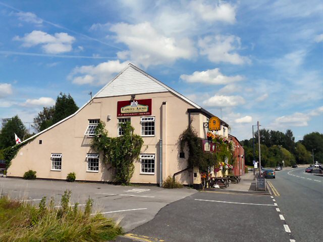
Image: © Gerald England Taken: 11 Aug 2009
The Lowe's Arms Public House stands on the north side of Hyde Road, Haughton, just above Broomstair Bridge across the River Tame. At first it faced Old Broom Lane, which was the then the main road connecting Haughton with Hyde via a ford across the river. In 1818 the turnpike road between Manchester and Hyde was completed and this passed behind the house. Subsequently, the front and back of the house were reversed so that it stood on the turnpike (Hyde Road). On the 2 May 1823 an indenture was drawn up between John Lowe, George Gosling and Jonathan Gibbons for Gosling and Gibbons to lease the house but in the following year Charles Knott took over the lease. At this time the building was little more than a terraced house but with the coat of arms of the Lowe and Sidebotham families over the doorway. The Sidebotham family of Bowden, Cheshire, were landowners in Haughton. Nearby, there were two coal pits. Broomstair Colliery was on the opposite side of Hyde Road to the house and Jet Amber Mine was on the same side in Jet Amber Fields, Farmers Fold, lying between the house and the river. As a result, miners frequented the Lowe's Arms. It was recorded that beer was then 2d a pint and each miner would put half-a-crown (2s 6d) on the table. This meant that each miner could consume up to 15 pints of beer! Information from a now dead web page originally on the "pittdixon" website.
Images are licensed for reuse under creativecommons.org/licenses/by-sa/2.0
Image Location
Latitude
53.455136
Longitude
-2.096491