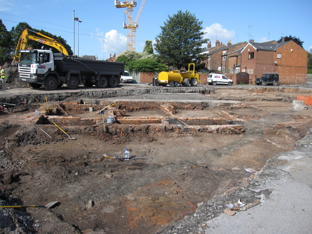
House outlines in Kinaston Street
Introduction
The photograph on this page of House outlines in Kinaston Street by John S Turner as part of the Geograph project.
The Geograph project started in 2005 with the aim of publishing, organising and preserving representative images for every square kilometre of Great Britain, Ireland and the Isle of Man.
There are currently over 7.5m images from over 14,400 individuals and you can help contribute to the project by visiting https://www.geograph.org.uk

Image: © John S Turner Taken: 6 Aug 2009
Looking from St Martins Way across the remains of Kinaston Street. In the 1960s and 1970s this area was cleared, in part to make way for the inner ring road, which is behind the camera. Now the site is to be redeveloped and it is being excavated. The camera angle is looking diagonally across the cobbled street, which, according to the 1851 census, only had 7 houses on each side. I assume that each square is one house, and they don't look very big. As far as I can ascertain Kinaston Street (later Kynaston Street) first appeared on the 1851 census and one of the residents was a George Kinaston (junior). George Kinaston (senior), a 'Fringe Maker', lived in the adjacent St Anne's Street and his will, dated 1857, refers to him as a 'Gentleman', and 'former fringe maker', and to his 'freehold property in St Anne Street', so as a man of substance it seems likely that the street was named by, or after, him. Although these houses would be considered very poor accommodation by today's standards, they were occupied in 1851 by a seemingly respectable group of people including a Brewer, a Gentleman's Servant, 3 Police Constables, a Tailor, a Lay Vicar at the Cathedral, a Coach Body Maker, and a Confectioner who was George Kinaston (junior). The extant houses on the right are St Anne's Street, which was cut through when the inner ring road was built. The cobbled cul de sac of Kinaston Street exited onto St Anne's Street before the ring road was built.

