The Roundhouse on Mill Lane
Introduction
The photograph on this page of The Roundhouse on Mill Lane by Martin Speck as part of the Geograph project.
The Geograph project started in 2005 with the aim of publishing, organising and preserving representative images for every square kilometre of Great Britain, Ireland and the Isle of Man.

There are currently over 7.5m images from over 14,400 individuals and you can help contribute to the project by visiting https://www.geograph.org.uk
The Roundhouse on Mill Lane
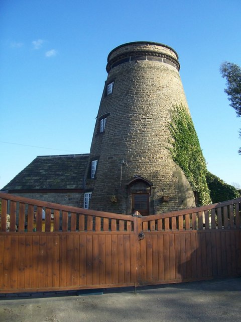
Image: © Martin Speck Taken: 29 Mar 2009
This is one of two former windmills on the Wentworth Estate. This windmill on Mill Lane appears to have been called The Old Mill Barrow on the 1891 census registration district documents. It was marked as Wentworth Mill (corn) on the 1892-1893 1:2500 OS map and the 1905-1907 1:2500 OS map. The mill is described as being Wentworth Mill (disused) on the 1930-1931 OS print. The Sheffield A-Z by the Geographers A-Z Map Company (Edition 1 1991) shows the mill on Mill Lane as being called Wentworth Mill. More recently it is called the Roundhouse on the OS-Phillip's Street Atlas 1997, and modern maps. The nearby windmill on Clayfield Lane, also on the Wentworth Estate is also known as the Roundhouse (sometimes Round House), and appears to have been called Wentworth Mill on the 1891 census registration district documents, but probably was given the name The Saxon Tower.
Images are licensed for reuse under creativecommons.org/licenses/by-sa/2.0
Image Location
Latitude
53.482765
Longitude
-1.430953