Welby Brook and Brook Crescent, Asfordby Valley
Introduction
The photograph on this page of Welby Brook and Brook Crescent, Asfordby Valley by Kate Jewell as part of the Geograph project.
The Geograph project started in 2005 with the aim of publishing, organising and preserving representative images for every square kilometre of Great Britain, Ireland and the Isle of Man.

There are currently over 7.5m images from over 14,400 individuals and you can help contribute to the project by visiting https://www.geograph.org.uk
Welby Brook and Brook Crescent, Asfordby Valley
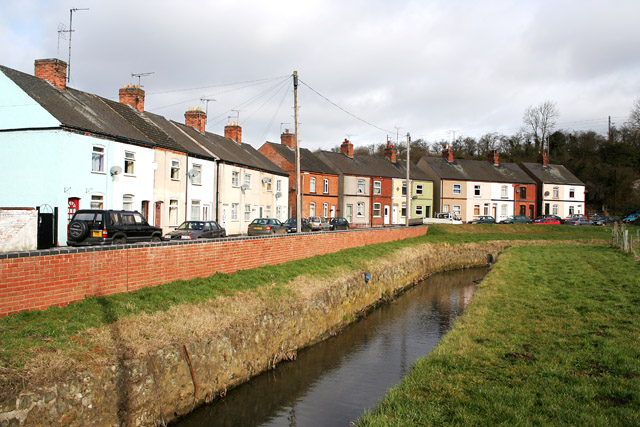
Image: © Kate Jewell Taken: 26 Mar 2006
This small village was subject to severe flooding on a regular basis. The Welby Brook is one of four Critical Ordinary Watercourses (small streams that have been identified as representing the greatest flood risk to people and property) in Melton Mowbray. A flood alleviation scheme was carried out in 2005 when a series of walls and bunds to hold back water during peak flows were built.
Images are licensed for reuse under creativecommons.org/licenses/by-sa/2.0
Image Location


Leaflet Map data © OpenStreetMap
Latitude
52.766536
Longitude
-0.937307