Eaglesham Parish Church
Introduction
The photograph on this page of Eaglesham Parish Church by Kenneth Mallard as part of the Geograph project.
The Geograph project started in 2005 with the aim of publishing, organising and preserving representative images for every square kilometre of Great Britain, Ireland and the Isle of Man.

There are currently over 7.5m images from over 14,400 individuals and you can help contribute to the project by visiting https://www.geograph.org.uk
Eaglesham Parish Church
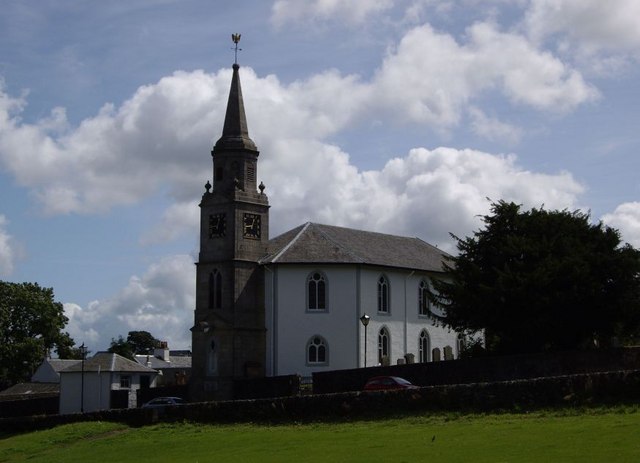
Image: © Kenneth Mallard Taken: 2 Aug 2009
Eaglesham Parish Church in Montgomery Street as viewed from the Glebe. It is probable that there has been a place of worship here since the fifth or sixth centuries. The present church was designed by Robert McLachlane and completed in 1790. The church was originally a small octagonal building and later extended. A memorial http://www.geograph.org.uk/photo/1821589 to Covenanters Robert Lockhart and Gabriel Thomson who were shot by Highlandmen and Dragoons under the command of Ardencaple for their adherence to the Solemn League and Covenant as they returned from a coventicle on 1st May 1685, stands in the kirkyard. The inscription on the memorial has probably been transcribed from a more ancient headstone. Click on these links to discover about places of worship and the Covenanters http://www.geograph.org.uk/photo/1484274 http://www.geograph.org.uk/photo/1897780 http://www.geograph.org.uk/photo/1432415 http://www.geograph.org.uk/photo/2385555 or to see the weather vane atop the Parish Church steeple http://www.geograph.org.uk/photo/1532008 .
Images are licensed for reuse under creativecommons.org/licenses/by-sa/2.0
Image Location
Latitude
55.739424
Longitude
-4.273055