M1 Motorway near Redbourn
Introduction
The photograph on this page of M1 Motorway near Redbourn by Nigel Cox as part of the Geograph project.
The Geograph project started in 2005 with the aim of publishing, organising and preserving representative images for every square kilometre of Great Britain, Ireland and the Isle of Man.

There are currently over 7.5m images from over 14,400 individuals and you can help contribute to the project by visiting https://www.geograph.org.uk
M1 Motorway near Redbourn
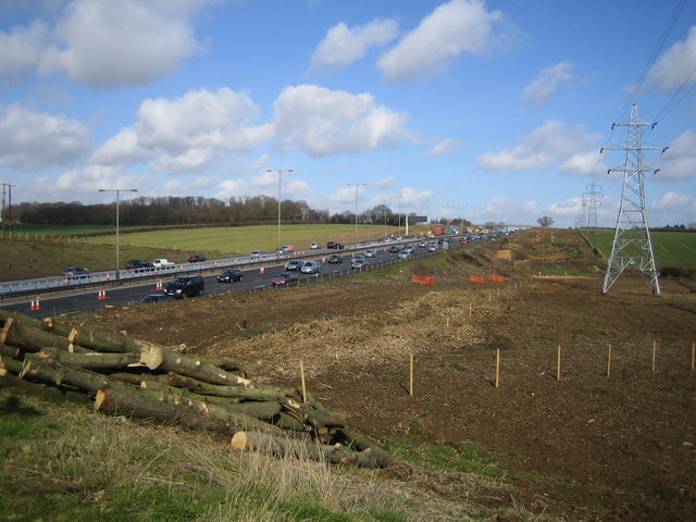
Image: © Nigel Cox Taken: 25 Mar 2006
Viewed looking north from the Flamsteadbury Farm overbridge, this section of the motorway, between Junctions 8 and 9, is about to be widened to four lanes in each direction. Two wide swathes of land on either side have already been cleared of vegetation. The motorway currently carries an average of 160,000 vehicles per day between these junctions and is often subject to delays. The total cost of the improvement works is estimated to be about £214 million.
Images are licensed for reuse under creativecommons.org/licenses/by-sa/2.0
Image Location


Leaflet Map data © OpenStreetMap
Latitude
51.797738
Longitude
-0.413514