Old Clergy House, Boyn Hill
Introduction
The photograph on this page of Old Clergy House, Boyn Hill by Derek Harper as part of the Geograph project.
The Geograph project started in 2005 with the aim of publishing, organising and preserving representative images for every square kilometre of Great Britain, Ireland and the Isle of Man.

There are currently over 7.5m images from over 14,400 individuals and you can help contribute to the project by visiting https://www.geograph.org.uk
Old Clergy House, Boyn Hill
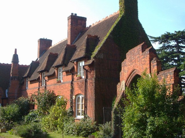
Image: © Derek Harper Taken: 9 Sep 2005
This forms the western side of the quadrangle of Church Close, of which Image forms the north. "Added by G E Street in 1859 at right angles to and adjoining Parish Centre north side" http://www.imagesofengland.org.uk/Details/Default.aspx?id=40729&mode=adv , which implies that this was originally Boyn Hill Infants School. On the right is the stepped entrance gateway to the close http://www.imagesofengland.org.uk/details/default.aspx?id=40731 .
Images are licensed for reuse under creativecommons.org/licenses/by-sa/2.0
Image Location
Latitude
51.519676
Longitude
-0.736973