Boyn Hill
Introduction
The photograph on this page of Boyn Hill by Derek Harper as part of the Geograph project.
The Geograph project started in 2005 with the aim of publishing, organising and preserving representative images for every square kilometre of Great Britain, Ireland and the Isle of Man.

There are currently over 7.5m images from over 14,400 individuals and you can help contribute to the project by visiting https://www.geograph.org.uk
Boyn Hill
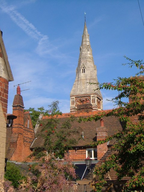
Image: © Derek Harper Taken: 9 Sep 2005
The spire of All Saints Church appears over the roofs of Church Close. "The Church ... is part of a tractarian group ..., comprising the former All Saints Vicarage, All Saints School and Schoolmaster's House, All Saints Almshouses and Vicarage Lodge" http://www.imagesofengland.org.uk/Details/Default.aspx?id=40726&mode=adv . The original architect of the 1850s church (also seen in Image) was G E Street. In front is the rear of Vicarage Cottage, contemporaneous http://www.imagesofengland.org.uk/Details/Default.aspx?id=40722&mode=adv . Seen from Boyn Hill Avenue.
Images are licensed for reuse under creativecommons.org/licenses/by-sa/2.0
Image Location
Latitude
51.519855
Longitude
-0.736824