Friday Wood
Introduction
The photograph on this page of Friday Wood by Glyn Baker as part of the Geograph project.
The Geograph project started in 2005 with the aim of publishing, organising and preserving representative images for every square kilometre of Great Britain, Ireland and the Isle of Man.

There are currently over 7.5m images from over 14,400 individuals and you can help contribute to the project by visiting https://www.geograph.org.uk
Friday Wood
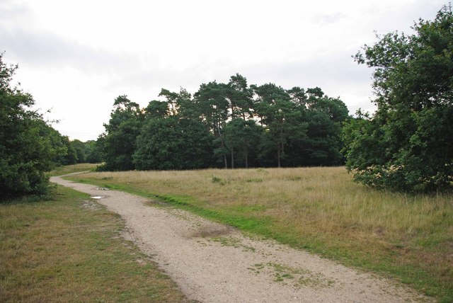
Image: © Glyn Baker Taken: 19 Jul 2009
If you had stood at this point in the early 1970’s you would have seen the spinney of Scots pines in the middle of the picture isolated in a buff sea of sand and gravel. You could have seen right through to the broad leafed ancient wood behind. More enlightened management of this army training ground like keeping vehicles to the tracks has allowed grass and finally secondary woodland to colonise what was essentially a desert (according to the propaganda that comes with Essex Water Company Bills we get less annual rainfall around here than in Jerusalem! Our water comes throughout the year but they get a drenching all at once in the winter).
Images are licensed for reuse under creativecommons.org/licenses/by-sa/2.0
Image Location
Latitude
51.852084
Longitude
0.885266