Monmouthshire & Brecon Canal, Mamhilad
Introduction
The photograph on this page of Monmouthshire & Brecon Canal, Mamhilad by Stephen McKay as part of the Geograph project.
The Geograph project started in 2005 with the aim of publishing, organising and preserving representative images for every square kilometre of Great Britain, Ireland and the Isle of Man.

There are currently over 7.5m images from over 14,400 individuals and you can help contribute to the project by visiting https://www.geograph.org.uk
Monmouthshire & Brecon Canal, Mamhilad
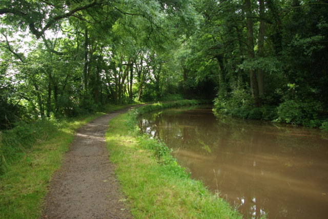
Image: © Stephen McKay Taken: 24 Jul 2009
The Monmouthshire and Brecon Canal is considered by many to be the most beautiful of all British waterways and here at Mamhilad it is not hard to see why. This looks and feels to be a lonely remote spot although the small village of Mamhilad is actually not far away, with access from High Bridge, just out of sight round the bend. Boaters will probably know it for the village pub - the Star. The Monmouthshire and Brecon Canal is in fact an amalgamation of two canals - the Monmouthshire, which ran north from Newport to Pontymoile Basin at Pontypool, and the Brecknock & Abergavenny which continued northwards, past this point, to Brecon. The main traffic was coal and iron, although the northern end conveyed mainly agricultural produce and was probably never really viable. In any event by the mid 19th century - only 50 years or so after opening - the canal began to feel the effects of competition from the railways and commercial carrying had ceased by the early years of the 20th century. Nevertheless, the canal was retained as a water channel so that, despite formal abandonment in 1962, subsequent restoration was possible. Inevitably, this is a more difficult task at the more urban southern end of the canal and at present it is not possible to navigate through Cwmbran. Eventually, however, it is hoped to reopen the entire route from Newport to Brecon.
Images are licensed for reuse under creativecommons.org/licenses/by-sa/2.0
Image Location
Latitude
51.725418
Longitude
-3.010507