Canford Heath: postbox № BH17 219, Tollerford Road
Introduction
The photograph on this page of Canford Heath: postbox № BH17 219, Tollerford Road by Chris Downer as part of the Geograph project.
The Geograph project started in 2005 with the aim of publishing, organising and preserving representative images for every square kilometre of Great Britain, Ireland and the Isle of Man.

There are currently over 7.5m images from over 14,400 individuals and you can help contribute to the project by visiting https://www.geograph.org.uk
Canford Heath: postbox № BH17 219, Tollerford Road
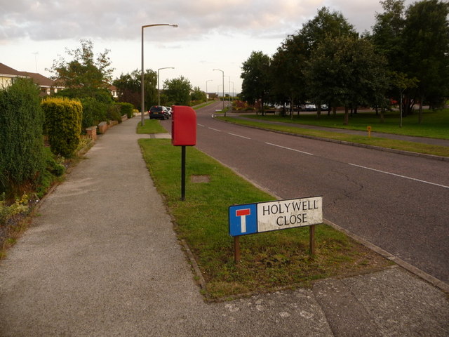
Image: © Chris Downer Taken: 27 Jul 2009
This little postbox serves the northern extremity of the vast 70s housing estate of Canford Heath. It is emptied finally at 5:30pm on weekdays and at noon on Saturdays. Most of the roads in this part of the estate are named after Dorset locations, such as Holywell Close and Tollerford Road, the pictured roads.
Images are licensed for reuse under creativecommons.org/licenses/by-sa/2.0
Image Location
Latitude
50.755404
Longitude
-1.974998