The south end of Queensway, Leamington Spa
Introduction
The photograph on this page of The south end of Queensway, Leamington Spa by Robin Stott as part of the Geograph project.
The Geograph project started in 2005 with the aim of publishing, organising and preserving representative images for every square kilometre of Great Britain, Ireland and the Isle of Man.

There are currently over 7.5m images from over 14,400 individuals and you can help contribute to the project by visiting https://www.geograph.org.uk
The south end of Queensway, Leamington Spa
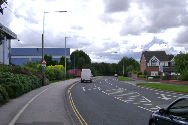
Image: © Robin Stott Taken: 24 Jul 2009
OS can't keep pace with all the new businesses and industrial premises, and new roads to serve them, springing up on the site of the huge old Automotive Products works and other industrial estates in south Leamington. On the extreme left is a unit in Jephson Court/Tancred Close. Straight ahead is the rear of Aga/Rangemester off Juno Drive (they have another site pictured in this square). On the right is an estate of shoebox houses - Sapphire Drive and Emerald Way.
Images are licensed for reuse under creativecommons.org/licenses/by-sa/2.0
Image Location
Latitude
52.275941
Longitude
-1.536812