The Westlink, York Street, Belfast
Introduction
The photograph on this page of The Westlink, York Street, Belfast by Albert Bridge as part of the Geograph project.
The Geograph project started in 2005 with the aim of publishing, organising and preserving representative images for every square kilometre of Great Britain, Ireland and the Isle of Man.

There are currently over 7.5m images from over 14,400 individuals and you can help contribute to the project by visiting https://www.geograph.org.uk
The Westlink, York Street, Belfast
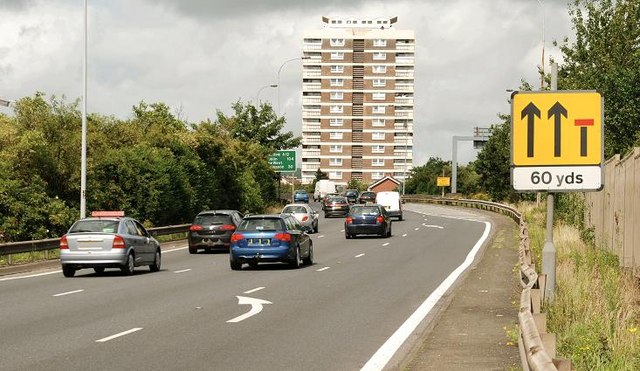
Image: © Albert Bridge Taken: 26 Jul 2009
See Image and Image The start of the Westlink, at York Street for traffic heading towards the M1. There are (resurrected) plans for a major elevated interchange here to connect the road to the M2 and M3. The route confirmatory sign (middle) shows the distance to Dublin as 104 miles.
Images are licensed for reuse under creativecommons.org/licenses/by-sa/2.0
Image Location
Latitude
54.607078
Longitude
-5.927875