Henry Street, Belfast
Introduction
The photograph on this page of Henry Street, Belfast by Albert Bridge as part of the Geograph project.
The Geograph project started in 2005 with the aim of publishing, organising and preserving representative images for every square kilometre of Great Britain, Ireland and the Isle of Man.

There are currently over 7.5m images from over 14,400 individuals and you can help contribute to the project by visiting https://www.geograph.org.uk
Henry Street, Belfast
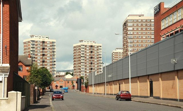
Image: © Albert Bridge Taken: 26 Jul 2009
The Google map shows Hill Street Image as “Henry Street”. Accept no substitutes – this is the real Henry Street. It runs from York Street to North Queen Street (background). The former Gallaher’s factory Image is on the right. The Artillery Flats are in the background.
Images are licensed for reuse under creativecommons.org/licenses/by-sa/2.0
Image Location
Latitude
54.608509
Longitude
-5.927493