Former Congregational Church, St Matthew's Road
Introduction
The photograph on this page of Former Congregational Church, St Matthew's Road by Stephen Richards as part of the Geograph project.
The Geograph project started in 2005 with the aim of publishing, organising and preserving representative images for every square kilometre of Great Britain, Ireland and the Isle of Man.

There are currently over 7.5m images from over 14,400 individuals and you can help contribute to the project by visiting https://www.geograph.org.uk
Former Congregational Church, St Matthew's Road
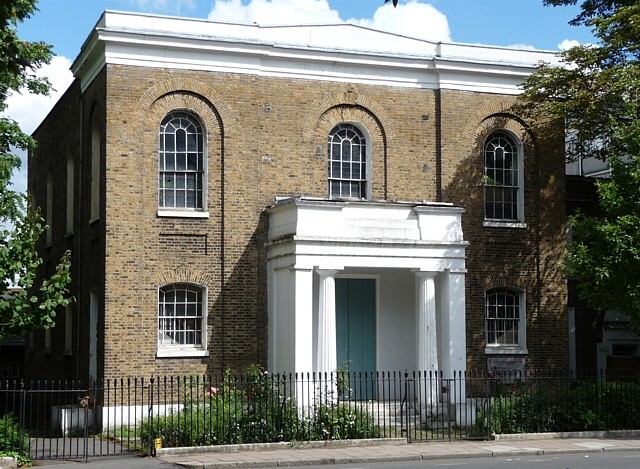
Image: © Stephen Richards Taken: 23 Jul 2009
A simple but pleasing late-Georgian (1828) stock brick box, with a Greek Doric porch in antis. Though in use, it has clearly suffered from some neglect as it is on English Heritage's Heritage at Risk Register. Grade II listed. It is now largely marooned among modern housing estates, but a few houses of a similar vintage survive further down the street.
Images are licensed for reuse under creativecommons.org/licenses/by-sa/2.0
Image Location
Latitude
51.457571
Longitude
-0.116003