Claypon's Tramroad Extension
Introduction
The photograph on this page of Claypon's Tramroad Extension by Alan Bowring as part of the Geograph project.
The Geograph project started in 2005 with the aim of publishing, organising and preserving representative images for every square kilometre of Great Britain, Ireland and the Isle of Man.

There are currently over 7.5m images from over 14,400 individuals and you can help contribute to the project by visiting https://www.geograph.org.uk
Claypon's Tramroad Extension
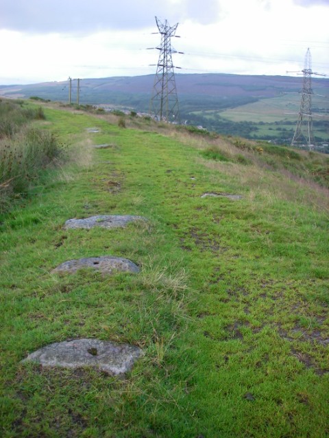
Image: © Alan Bowring Taken: 23 Jul 2009
Numerous lumps of hard gritstone with drilled holes on their upper surface bear testimony to the fact that a busy tramroad once went his way.
Images are licensed for reuse under creativecommons.org/licenses/by-sa/2.0
Image Location


Leaflet Map data © OpenStreetMap
Latitude
51.769551
Longitude
-3.735263