Former Methodist Chapel, Wooburn Green
Introduction
The photograph on this page of Former Methodist Chapel, Wooburn Green by David Hillas as part of the Geograph project.
The Geograph project started in 2005 with the aim of publishing, organising and preserving representative images for every square kilometre of Great Britain, Ireland and the Isle of Man.

There are currently over 7.5m images from over 14,400 individuals and you can help contribute to the project by visiting https://www.geograph.org.uk
Former Methodist Chapel, Wooburn Green
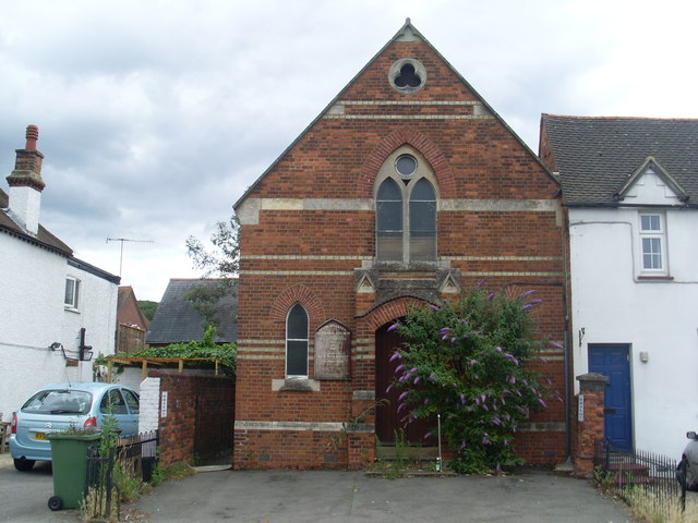
Image: © David Hillas Taken: 9 Jul 2009
Situated in the East side of The Green, this chapel dates from 1873. It had its final services on Sunday 1st June, 2008. The buddleia shrub with its mauvre flowers, seems to be taking over the front of the chapel, which will hopefully attract the butterflies. Its postcode is HP10 0EF.
Images are licensed for reuse under creativecommons.org/licenses/by-sa/2.0
Image Location
Latitude
51.588217
Longitude
-0.681809