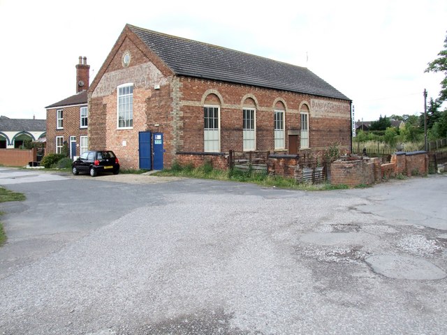
Drill Hall Antiques Centre, Horncastle
Introduction
The photograph on this page of Drill Hall Antiques Centre, Horncastle by Dave Hitchborne as part of the Geograph project.
The Geograph project started in 2005 with the aim of publishing, organising and preserving representative images for every square kilometre of Great Britain, Ireland and the Isle of Man.
There are currently over 7.5m images from over 14,400 individuals and you can help contribute to the project by visiting https://www.geograph.org.uk

Image: © Dave Hitchborne Taken: 18 Jul 2009
This building has seen many uses. Around 1900, when first built, it was a school. Then, until the New Drill Hall was built, http://www.geograph.org.uk/photo/1409072 it was used by the Horncastle Rifle Volunteers, which incidentally started out in 1859. Danby & Cheseldine used it next as a coach works and as the building has pig pens outside, it is reasonable to assume they may have upholstered the carriage seats with pig skin. The name, which was painted on the brickwork outside, still remains - http://www.geograph.org.uk/photo/1408937 http://www.geograph.org.uk/photo/1408987 The frontage - http://www.geograph.org.uk/photo/1408871 The building was then used as an agricultural store, which I vaguely remember. I think it housed farming equipment for a firm across the road. Whizzkids then made a children's play centre out of it, until it became an antique centre. Horncastle has become something of an Antiques Capital, so this made sense. With regard to the pig pens. In the 13th century Horncastle's market was established. It became a bustling place, and later, internationally so with horses. Traders also dealt with cattle, sheep and pigs and cattle and sheep pens are still to be seen at the rear of this building. The remains of pigs and sheep sometimes ended up in the canal, (opened in 1759) which is just a few yards away.

