Orlit 'B' Aircraft Observation Building
Introduction
The photograph on this page of Orlit 'B' Aircraft Observation Building by James T M Towill as part of the Geograph project.
The Geograph project started in 2005 with the aim of publishing, organising and preserving representative images for every square kilometre of Great Britain, Ireland and the Isle of Man.

There are currently over 7.5m images from over 14,400 individuals and you can help contribute to the project by visiting https://www.geograph.org.uk
Orlit 'B' Aircraft Observation Building
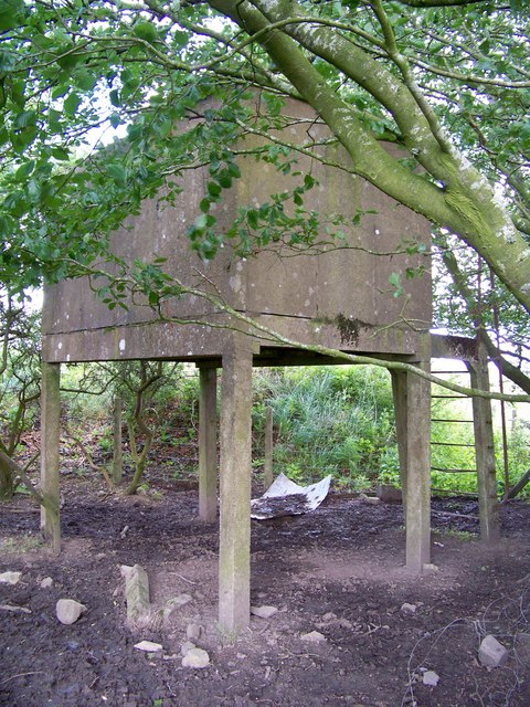
Image: © James T M Towill Taken: 20 Jul 2009
An 'Orlit' (pre-cast concrete) 'B' elevated aircraft observation building. This is a rectangular building 10' by 6'8". The building was split into two sections, the entrance door led into the smaller roofed section which was used as a shelter and store with a sliding door into the open section which housed the post instrument and chart on top of a wooden mounting. An Orlit 'B' is raised on stilts to 4' 6" with a wire ladder for access. Canonbie ROC Post is next to this building.
Images are licensed for reuse under creativecommons.org/licenses/by-sa/2.0
Image Location
Latitude
55.093652
Longitude
-2.938526